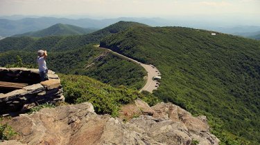
Blue Ridge Parkway Increases Recreational Access to Campgrounds in NC and VA

Thursday, July 30, 2020

No comments
Following guidance from the White House, Centers for Disease Control and Prevention (CDC), and state and local public health authorities, Blue Ridge Parkway is increasing recreational access at campgrounds in both Virginia and North Carolina. The National Park Service (NPS) is working service-wide with federal, state, and local public health authorities to closely monitor the COVID-19 pandemic and using a phased approach to increase access on a park-by-park basis.

Beginning July 31, 2020, the Blue Ridge Parkway will reopen access to four campgrounds at the following locations:

Virginia:

* Peaks of Otter Campground, Milepost 85.9
* Rocky Knob Campground, Milepost 169

North Carolina:

* Julian Price Park Campground, Milepost 297
* Linville Falls Campground, Milepost 316.4

Reservations for each location are now available through www.recreation.gov with dates beginning July 31.

While these areas are accessible for visitors to enjoy, a return to full operations will continue to be phased and services may be limited. When recreating, the public should follow local area health orders in North Carolina and Virginia, practice Leave No Trace principles, avoid crowding and avoid high-risk outdoor activities.

Details and updates on park operations will continue to be posted on the park website at www.nps.gov/blri and social media channels


Jeff
HikingintheSmokys.com
RockyMountainHikingTrails.com
HikinginGlacier.com
TetonHikingTrails.com

Ramble On: A History of Hiking
Exploring Glacier National Park
Exploring Grand Teton National Park
Read More

Smokies Cites SARs Stat in Facebook Post

Tuesday, July 28, 2020

No comments
The Great Smoky Mountains National Park cited an interesting stat in a Facebook post earlier today with regards to Search and Rescues (SARs) within the park. Here's the post:
Know your limits!

Before heading into the Park please plan and prepare accordingly. #trailstuesday

Whether it is for a multi-day adventure, a quick day hike, or even just a drive through the Park, things can go wrong in a jiffy!

Park staff respond to over 100 Search and Rescues every year, many of which could be avoided with proper planning and preparation. It is critical, especially during the ongoing health crisis, that visitors make wise decisions to help keep themselves, our rangers, and our first responders out of harms way. #searchandrescue

People often overestimate their abilities and underestimate the Smokies. Start with a short hike stay on trail, and play it safe! #recreateresponsibly #knowyourlimits

Check out the NPS’s list of ‘Ten Essentials’, for when venturing into the backcountry: https://www.nps.gov/articles/10essentials.htm

For information to help you plan your trip and to get updates on current Park conditions please visit the Park website: https://www.nps.gov/grsm/index.htm
Although not a world news item, I have never seen any SAR data for the Smokies. I did some research for my book, Ramble On: A History of Hiking, with regards to SARs in the entire national park system, and found out that the Grand Canyon used to account for more than 10% of all SARs across the entire system. During the late-80s and early-90s, the park recorded roughly 482 SARs each year. The park has been able to reduce that number by 25% in recent years, due to programs geared to help better educate visitors about the dangers of hiking in the park. Most interestingly, however, is that the Smokies records "only" 100 SARs each year, compared to roughly 360 for the Grand Canyon. That difference is magnified even more when you take into account that the Smokies has more than twice the number of visitors each year!

In addition to the resources cited in the Smokies Facebook post above, you can also find a list of safety tips for hiking in the Smokies on our website. You can also use our list of hikes sorted by difficulty rating to help you find a hike that's best suited to your abilities.


Jeff
HikingintheSmokys.com
RockyMountainHikingTrails.com
HikinginGlacier.com
TetonHikingTrails.com

Ramble On: A History of Hiking
Exploring Glacier National Park
Exploring Grand Teton National Park
Read More

Tunnel Ridge Road in Red River Gorge closed 3 weeks in August

Saturday, July 25, 2020

No comments
Tunnel Ridge Road (Forest Route 39) in the Red River Gorge portion of the Daniel Boone National Forest will be closed approximately 3 weeks starting August 3. The Kentucky Transportation Cabinet announced a restoration project on the bridge carrying Tunnel Ridge Road over the Mountain Parkway. Tunnel Ridge Road provides access to popular destinations such as Gray’s Arch and Auxier Ridge.

The bridge will be closed to all traffic -- vehicular, pedestrian, and bicycle -- during the work. Signs will be posted notifying drivers and hikers of the closure. Please do not park vehicles in front of closed gates or block emergency vehicle access. Gates will close Sunday, August 2, at 9:00 pm with a tentative reopening August 21.

The Kentucky Transportation Cabinet also announced that the westbound lanes of the Mountain Parkway have been closed indefinitely from Pine Ridge exit 40 to Slade exit 33 due to a collapse of the roadbed beneath the pavement near the Tunnel Ridge Road underpass. Westbound traffic is being detoured onto northbound KY 15 from Pine Ridge to Slade.

To accommodate truck traffic on the detour route, the southbound lane of KY 15 has been closed at Slade. Uphill traffic on Slade Hill will be blocked. To access National Forest sites such as Koomer Ridge Campground and Tunnel Ridge Road, visitors should take Pine Ridge exit 40 off the Mountain Parkway and then KY 15.

For additional information, please contact the Cumberland Ranger District at 606-784-6428 or visit the Daniel Boone National Forest website at www.usda.gov/dbnf.

Updates will also be posted on Facebook for Daniel Boone National Forest: https://www.facebook.com/danielboonenf/


Jeff
HikingintheSmokys.com
RockyMountainHikingTrails.com
HikinginGlacier.com
TetonHikingTrails.com

Ramble On: A History of Hiking
Exploring Glacier National Park
Exploring Grand Teton National Park
Read More

Great Smoky Mountains Proposes Mountain Bike Trail System in Wears Valley

Wednesday, July 22, 2020

No comments
Great Smoky Mountains National Park is proposing a mountain bike trail system within the Foothill Parkway Section 8D corridor in Wears Valley, Sevier County, Tennessee.

The proposed project is needed because recreational access and opportunities are currently limited along unfinished sections of the Foothills Parkway, including Section 8D. The GSMNP General Management Plan and the original Foothills Parkway Master Plan, envisioned some form for recreational development in the Wears Valley area, but none currently exist. Community interest in exploring possible recreational opportunities along undeveloped sections of the Foothills Parkway has increased. The Conservation Fund recently began engaging the National Park Service and community stakeholders to identify specific recreational opportunities that would not conflict with future completion of the Parkway as envisioned by Congress. This process identified mountain biking as a potentially compatible opportunity, with strong community interest in establishing a network of trails specifically designed for mountain biking use. Recommendations included further analysis of opportunities to develop a mountain bike trail system in the Wears Valley portion of Section 8D.

While more than 800 miles of trails exist in the Park, less than 8 miles are open to biking and there are no by-design mountain biking trails. Most of the Park's trails are in areas managed as wilderness where bikes are not permitted. The Foothills Parkway corridor, which is within the Park's transportation management zone and is not managed as wilderness, could provide visitors new opportunities to experience the park through mountain biking.

Two, two-hour virtual meetings have been scheduled for 7/28 and 7/30. Both will begin at 5:00 PM. For more information, and to participate in the meetings, please click here.

The comment period for this project closes on Aug 19, 2020. For more information on the project, and to comment, please click here.


Jeff
HikingintheSmokys.com
RockyMountainHikingTrails.com
HikinginGlacier.com
TetonHikingTrails.com

Ramble On: A History of Hiking
Exploring Glacier National Park
Exploring Grand Teton National Park
Read More

Friends of the Smokies Resumes Classic Hikes of the Smokies Series

Tuesday, July 21, 2020

No comments
As reported this past March, Friends of the Smokies was forced to postpone their Classic Hikes of the Smokies series due to the Covid outbreak. For those interested, the "Friends" group has recently resumed the series with a hike to Catalooche Divide last week. Fortunately there are several more hikes scheduled through the remainder of the year if anyone wishes to participate, and help support this important organization. The series provides funds that help support the restoration and rehabilitation of some of the park's most popular trails through its Trails Forever program.

Please note that pre-registration is required to participate. Here's a rundown of the remaining hikes in this year's series:

August 11 - Boogerman Loop

September 8 - A.T. to Mt. Cammerer

October 13 - Andrews Bald

November 10 - Lost Cove Loop (includes a visit to the Shuckstack Fire Tower)

December 8 - Smokemont Loop

For more information, and to register, please click here.


Jeff
HikingintheSmokys.com
RockyMountainHikingTrails.com
HikinginGlacier.com
TetonHikingTrails.com

Ramble On: A History of Hiking
Exploring Glacier National Park
Exploring Grand Teton National Park
Read More

New Discount for Tennessee Residents at State Parks

Friday, July 17, 2020

No comments
Tennessee State Parks is now offering a 10% Tennessee Resident Discount to make spending the night in the outdoors even more affordable. Residents can take advantage of the new 10% discount by phone or online at reserve.tnstateparks.com.

Tennessee State Parks believe in the power and importance of spending time outside. That is why Tennessee is one of only six states to allow visitors to enter free of charge. While enjoying a few hours at a park is wonderful, there’s something unique and refreshing about spending the night. Tennessee State Parks want to make that overnight experience attractive and accessible to as many Tennesseans as possible.

“Our hope is that all Tennesseans - especially young adults, new residents, families with small kids, and price-sensitive travelers - will get outside and discover the beauty and wonder of your state parks,” said Jim Bryson, Deputy Commissioner of Parks & Conservation.

Discount Details:

* Tennessee Resident Discount will provide a 10% discount off the normal rate at most Tennessee State Park overnight accommodations.

* All Tennessee residents 18 and older with a valid state-issued photo ID will qualify.

* A Tennessee resident must occupy the campsite, cabin or lodge room in order to qualify.

* Guests must provide a current, valid state-issued photo ID that includes a valid Tennessee residence at time of check in for the discount to apply. Staff will not accept photocopies of the ID as proof of residency.

* Discount is available by phone, in person or online at reserve.tnstateparks.com.

* Tennessee Resident Discount cannot be combined with other existing discounts, such as Active Military, 100% Disabled Veteran, Senior, Disabled or Tennessee State Employee discounts.

* This discount only applies to campsites, cabins and lodge rooms. This discount does not apply to group facilities, boat rentals, permits, etc.

* The discount will not apply to premium campsites. Some cabin exclusions may apply.

* Discounts will not apply to reservations made prior to July 1, 2020.

Tennesseans looking to take advantage of the new discount can do so now at reserve.tnstateparks.com. Simply select the “Tennessee Resident Discount” during payment to take advantage of the new offer.


Jeff
HikingintheSmokys.com
RockyMountainHikingTrails.com
HikinginGlacier.com
TetonHikingTrails.com

Ramble On: A History of Hiking
Exploring Glacier National Park
Exploring Grand Teton National Park
Read More

National Forests in North Carolina Launch Digital Passes

Wednesday, July 15, 2020

No comments
Visitors to Nantahala and Pisgah National Forests will have a convenient new way to pay day use fees at several recreation sites starting this summer.

A new online platform allows visitors to pay day use fees using their personal computer or mobile device through Recreation.gov. There is no additional cost to pay fees online.

To purchase a pass, go directly to www.recreation.gov/sitepass/72611, search “National Forests in North Carolina Digital Passes” at the Recreation.gov homepage, or scan the QR code below. Some sites may have limited cell phone reception so users should purchase passes before heading to the destination. Passes can be printed and placed on the dashboard, though this is not required since rangers can validate license plates of passholders. Where cell service is good, passes can be purchased at recreation sites using a smartphone.

Digital Passes are available through Recreation.gov for the following sites:

* Cheoah Point Beach: $5, open through 10/31

* Dry Falls, Whiteside Mountain, and Whitewater Falls: $3, open year round (A pass purchased for Dry Falls, Whiteside Mountain, or Whitewater Falls are honored at all three locations)

* Jackrabbit Mountain Beach: $5, open through 9/30

* Roan Mountain: $3, open through 9/30

Recreation fee revenue helps protect natural resources and enhance recreation opportunities. These fees are critical to the operation and maintenance of recreation sites, including but not limited to cleaning, maintaining, and updating bathroom facilities, replacing sand at beaches, removing trash, mowing and maintaining grounds and parking lots, and replacing picnic tables and other amenities.

For more information on digital passes please visit www.recreation.gov/pass.


Jeff
HikingintheSmokys.com
RockyMountainHikingTrails.com
HikinginGlacier.com
TetonHikingTrails.com

Ramble On: A History of Hiking
Exploring Glacier National Park
Exploring Grand Teton National Park
Read More

Visitor Drowns at Blue Heron Area of Big South Fork

Tuesday, July 14, 2020

No comments
On July 10, at approximately 11:00 AM (ET), a male 52-year-old Stearns resident was swimming across from the Blue Heron Boat Launch with his family when he submerged underwater and never reappeared. The victim’s relatives reported the incident to park rangers 10 minutes later.

The victim's body was recovered that evening, at approximately 8:00 PM, with assistance from: Obed Wild & Scenic River, Pine Knot Fire, Whitley City Fire, McCreary County Sherriff’s Office, Kentucky State Police, Kentucky Fish and Game, Pulaski County Dive Team, Russell Springs Kentucky Dive Team.

Any body of water can be deadly, even if the water looks calm. It is essential to always wear a personal floatation device and know your abilities and water conditions before entering the water.

Drowning is the Number 1 cause of death at Big South Fork, with approximately one water-related fatality per year.

For information on river safety, please click here.


Jeff
HikingintheSmokys.com
RockyMountainHikingTrails.com
HikinginGlacier.com
TetonHikingTrails.com

Ramble On: A History of Hiking
Exploring Glacier National Park
Exploring Grand Teton National Park
Read More

Upcoming Single-Lane Closure on King Branch Road

Friday, July 10, 2020

No comments
Great Smoky Mountains National Park maintenance crews will implement a temporary, single-lane closure along King Branch Road on Tuesday, July 14 from 7:30 a.m. until 5:00 p.m. to make pavement repairs. King Branch Road is located off the northbound Spur near Pigeon Forge, TN. The road will remain open during the single-lane closure, but motorists should anticipate delays.

For more information about road closures, please follow SmokiesRoadsNPS on twitter or visit the park website at www.nps.gov/grsm/planyourvisit/temproadclose.htm.


Jeff
HikingintheSmokys.com
RockyMountainHikingTrails.com
HikinginGlacier.com
TetonHikingTrails.com

Ramble On: A History of Hiking
Exploring Glacier National Park
Exploring Grand Teton National Park
Read More

Access to Explore Park via the Blue Ridge Parkway Restored from the North

Wednesday, July 8, 2020

No comments
National Park Service (NPS) officials announced today that a section of the Blue Ridge Parkway from Milepost 112.4 to Milepost 115.5 is now open providing access to Explore Park from the north. This section is the northernmost portion of a larger closure put in place in late May after multiple landslides in the area. Access to Explore Park via the Parkway remains closed from the south, and through traffic on the parkway south of Explore Park (milepost 115.5) remains closed to Adney Gap (milepost 135.9).

On May 22, 2020, NPS officials announced heavy rain created multiple road hazards in the Roanoke, Virginia, area of the Parkway that required a road closure from milepost 112.4 to milepost 135.9, from U.S. Route 24 to Adney Gap.

Two road hazards in the sections that remain closed, at milepost 119.7 and milepost 127.9, require significant reconstruction and slide prevention measures prior to reopening. Repairs at the smaller of these slides (milepost 119.7) will take place first, in an effort to reopen the section from the Explore Park Access Rd (milepost 115.5) to U.S. 220 (milepost 121.4) by fall of 2020.

The largest hazard is a full road failure roughly one hundred and fifty feet (150') in length at milepost 127.9. This complex road failure will require a longer term closure for repair, and the estimated timeline for these repairs is still in development. Visitors are reminded that, due to the hazardous nature of this slope failure, the section of parkway from U.S. 220 (milepost 121.4) to Adney Gap (milepost 135.9) is closed to all uses including motor vehicles, bicycles and pedestrians.

Updates to the road status will be made when available on the park website at www.nps.gov/blri


Jeff
HikingintheSmokys.com
RockyMountainHikingTrails.com
HikinginGlacier.com
TetonHikingTrails.com

Ramble On: A History of Hiking
Exploring Glacier National Park
Exploring Grand Teton National Park
Read More

Precautionary Fish Consumption Advisory Issued by Obed Wild & Scenic River

Monday, July 6, 2020

No comments
On July 1, 2020, the Tennessee Department of Environment and Conservation (TDEC) announced a 6.7-mile extension of the existing precautionary fish consumption advisory due to mercury on the Emory River in Morgan County. Additionally, a new precautionary advisory due to mercury in smallmouth bass is being issued for a portion of Daddy’s Creek in Morgan and Cumberland Counties. Obed River fish were also tested on multiple occasions and were not found to have elevated levels of mercury. Obed Wild & Scenic River includes portions of Daddy’s Creek, the Obed River and Clear Creek. Common recreation activities on these streams include boating, fishing, wading and swimming.

TDEC provides these advisories so the community can make informed decisions about whether or not to consume the fish they catch. In a 2006 statewide screening of Tennessee rivers and lakes, Emory River was identified as a waterbody where mercury levels in fish were elevated and an advisory was issued in 2007. Additional studies by TDEC and the Tennessee Valley Authority indicated these elevated mercury levels in fish extended further upstream than previously thought.

This new notification expands the advisory 6.7 miles upstream to the mouth of the Obed River. The Emory advisory, which is for all fish species, now extends from US Hwy 27 (Mile 12.4) upstream to the mouth of the Obed River at mile 28.4. Only a short section of the upper Emory River is inside the Obed Wild & Scenic River.

The Daddy’s Creek precautionary advisory is for smallmouth bass only and will extend from its mouth on the Obed River upstream to Interstate 40, near Mile 20. This section includes the portion of the stream that was designated by Congress as a National Wild & Scenic River and includes the portion within Catoosa Wildlife Management Area.

TDEC advises that pregnant or nursing mothers and children avoid eating the fish species included in the advisory and that all others limit consumption to one meal per month. Other recreational activities such as boating, swimming, wading, and catch-and-release fishing carry no risk. Warning signs will be posted at public access areas.

Obed Wild & Scenic River is the only Wild & Scenic River in Tennessee. The State of Tennessee classifies Daddy’s Creek as an Exceptional Tennessee Water and the Obed River as an Outstanding National Resource Water.

For a complete listing of Tennessee’s current fishing advisories plus additional information about the advisory issuance process, visit: https://www.tn.gov/content/dam/tn/environment/water/documents/water_fish-advisories.pdf

An EPA website has additional information about mercury at: http://www2.epa.gov/fish-tech/epa-fda-advisory-mercury-fish-and-shellfish


Jeff
HikingintheSmokys.com
RockyMountainHikingTrails.com
HikinginGlacier.com
TetonHikingTrails.com

Ramble On: A History of Hiking
Exploring Glacier National Park
Exploring Grand Teton National Park
Read More

Smokies Adds New "Emergency Manager" Position

Thursday, July 2, 2020

No comments
Great Smoky Mountains National Park recently announced the hiring for a newly created "Emergency Manager" position. This new position will function to coordinate emergency medical response and search and rescue operations with responders inside the park in partnership with local agencies and organizations. Ranger Liz Hall will fill this new job. She will also lead preventative search and rescue efforts, such as providing safety information to hikers by staff and volunteers.

Ms. Hall comes to the Smokies from Yellowstone National Park, where she served in the Emergency Services office since 2017. Prior to her job in Emergency Services, Liz was a law enforcement ranger in the Lamar River District. Before working at Yellowstone National Park, Liz was a backcountry ranger at Klondike Gold Rush National Historical Park in Skagway, Alaska.

“I am excited that the park was able to fill this essential position with someone with the skill and experience that Liz holds,” added Lisa Hendy.

Liz has a master’s degree in public administration and is a Nationally Registered Paramedic. She spends her free time volunteering with a local search and rescue team and working her search and rescue dog, Reu. She also enjoys hiking, rock climbing, and boating. Liz grew up in Knoxville, Tennessee and she is excited to come home and work in the park that introduced her to conservation and the National Park Service. She is moving to the Smokies with her husband, Travis Hall, who is also a ranger, and their young son.


Jeff
HikingintheSmokys.com
RockyMountainHikingTrails.com
HikinginGlacier.com
TetonHikingTrails.com

Ramble On: A History of Hiking
Exploring Glacier National Park
Exploring Grand Teton National Park
Read More