prescribed fire
Showing posts with label prescribed fire. Show all posts

Prescribed Fire Season Begins in Nantahala National Forest

Saturday, March 2, 2013

No comments
This week the U.S. Forest Service announced that the prescribed burning season for the Tusquitee and Cheoah Ranger Districts in the Nantahala National Forest, will take place between early March and late April. The agency plans to conduct prescribed burning, during the dormant season, on approximately 1,353 acres on the district to help prevent wildfires and promote a healthy forest.

The Cheoah Ranger District plans to burn 1,400 to 2,500 acres each year. The prescribed burn areas in Graham County are located in the following areas:

* 822 acres at the Shell Stand area
* 352 acres near Cheoah Bald
* 80 acres at West Buffalo
* 88 acres at the Big Fat area
* 11 acres at the Cheoah Ranger District Helispot near the Cheoah District Office

The Tusquitee Ranger District plans to burn 3,500 to 5,000 acres each year, but due to the wet winter and other factors only 1,600 acres will be planned for burning this year. The prescribed burn areas in Cherokee County are located in the following areas:

* 450 acres at Ramsey Bluff
* 40 acres in the Beech Creek area
* In Clay County, the agency plans to conduct a 1,000-acre prescribed burn in the Leatherwood drainage located in the Fires Creek Recreation Area. 

Native plants and animals in the national forest depend on natural fire cycles, which are mimicked through the use of prescribed fires to balance habitat and food sources. Prescribed burns promote the growth of herbaceous plants that provide food, such as fruit, for wildlife including important game animals such as deer and turkey. Prescribed burns also benefit wildlife by increasing the abundance of many trees that produce nuts, particularly oaks, which do not germinate or grow well in dense, shady conditions.

Prescribed burning is also one of the most effective land management tools used in preventing the outbreak and spread of wildfires. Burning the same tract of land on a rotation of every three to seven years reduces the buildup of vegetation (fuel), decreasing the chance of severe wildfire.

For more information, contact Tim Solesbee at 828-479-6431. Individuals sensitive to smoke can call the Cheoah Ranger District at 828-479-6431 to be placed on the prescribed burn notification list.


Jeff
Hiking in the Smokies
Read More

Prescribed Fire Season at Cumberland Gap National Historical Park

Sunday, February 17, 2013

No comments
As part of a program to use "managed fire" inside the park, Cumberland Gap National Historical Park will be burning 286 acres near Tiprell, Tennessee in mid to late February. The goal is to reduce hazardous fuels near the town, and also to help maintain the type of historic forest found by Daniel Boone and Thomas Walker when they first arrived in the area.

"Managed fire," explained Chief Ranger Dirk Wiley, "is just another tool to help protect the park and our neighbors. It lets us burn a little, under very controlled conditions, so that we prevent a larger fire from threatening the park and nearby homes."

It sounds simple, but involves a complicated "prescription" that accounts for wind, fuel moisture, slope and sunshine, the spread of the smoke, and the effect of the fire on the existing plants. By carefully lighting the understory, the goal is to reduce the small fuels that can build up and create uncontrollable wildfires during dry periods. It also has the benefit of maintaining a forest that developed over thousands of years of fires set by Native Americans as part of their own desire to improve hunting.

The Tiprell fire will cover most of the hillside between Tiprell and the top of the ridge separating the park and Lincoln Memorial University. If all goes as planned, it will be done in one long day and the final result will be a subtle, but significant, reduction in both the fuels that carry fire and certain species of trees such as striped maple.

Park Ranger Shane Sturgill, "burn boss" for the fire, details that a successful prescribed fire will be almost invisible just a few months after the actual fire is gone. "It's not a raging fire," said Sturgill. "It's the kind of creeping ground fire that passes through the forest naturally."

The park will be notifying neighbors and nearby agencies on the day of the burn, and wants to make certain that nobody is alarmed by a sudden column of smoke inside the park. "It's just another day in the park," said Sturgill. "We're using fire as a tool to take care of the resources, the visitors, and our park neighbors."

The park encourages anyone with questions to contact Chief Ranger Dirk Wiley at (606) 246-1054, or email dirk_wiley@nps.gov.


Jeff
Hiking in the Smokies
Read More

Wildlife Commission Supports Prescribed Fire at Linville Gorge

Thursday, February 14, 2013

No comments
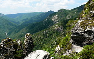
In a press release published earlier in the week, the N.C. Wildlife Resources Commission announced that it was joining other agencies and organizations in support of the controversial plan to use prescribed fire in the Linville Gorge Wilderness Area and adjacent National Forest System lands.

The Wildlife Commission stated that it supports a proposal the U.S Forest Service is considering to use prescribed fire on nearly 16,000 acres in and near the Linville Gorge Wilderness Area on the Grandfather Ranger District.

The Wildlife Commission said that prescribed fire would greatly reduce the risk of catastrophic wildfires, such as those that occurred in 2007, and help restore the fire-adapted ecosystem of the area. They note that prescribed fire will be particularly beneficial to fire-adapted plant species such as the rare Mountain Golden Heather that are at risk of disappearing due to decades of fire suppression. Wildlife species will also benefit from the controlled ignitions and less intense heat of a prescribed fire, as opposed to wildfires, which burn at a much higher intensity and have potential for large-scale spreading to adjacent private lands.

“Linville Gorge is the most fire-adapted area in the Grandfather Ranger District, meaning that its plants and wildlife need fire to thrive,” said Gordon Warburton, mountain area ecoregion supervisor for the Commission. “Fire once occurred naturally across North Carolina. Low-intensity fires burned every few years, fueled by grass, leaves, pine straw and other forest debris. Fire suppression over the past 100 years has left the gorge susceptible to wildfire,and the effects can be devastating for the region.”

The Wildlife Commission points out that using prescribed fire outside of the growing season will also promote and maintain a thick understory of berry-producing plants and grasses that provide key habitat and forage for wildlife. Critical mountain pine and oak habitats that need periodic low-intensity fires to maintain and promote regeneration, will also be favored through the use of prescribed fire, helping to restore the fire-adapted ecosystem native to this landscape. Past wildfires that have occurred in parts of this wilderness area have burned at high intensities during growing seasons, harming the forests, sterilizing soils, and providing areas for non-native invasive plants to establish.

For more information on hiking in the Linville Gorge, please click here.


Jeff
Hiking in the Smokies
Read More

Little Cataloochee Trail expected to be closed today

Thursday, April 15, 2010

No comments
Last week park managers at Great Smoky Mountains National Park announced plans to conduct a series of controlled burns in the Cataloochee Valley area near Maggie Valley.

The first burn is scheduled to begin today. As a result, the Little Cataloochee Trail may be closed today and tomorrow. Weather conditions will determine if the fire can be conducted. If you plan to hike in this area, you should plan an alternative hike in the event that the trail is closed when you arrive.

If wishing to hike in that area of the park today or tomorrow, check with the park website for the latest information.


Jeff
HikingintheSmokys.com Detailed information on trails in the Smoky Mountains; includes trail descriptions, key features, pictures, video, maps, elevation profiles, news, hiking gear store, and more.
Read More

Study supports the use of controlled burns

Wednesday, April 14, 2010

No comments
A Duke University study that reconstructs thousands of years of fire history in the southern Appalachians supports the use of prescribed fire, or controlled burns, as a tool to reduce the risk of wildfires, restore and maintain forest health and protect rare ecological communities in the region's forests.

Professor Norman Christensen Jr. and his team said their study, the first of its kind, involved radiocarbon analysis of 82 soil charcoal samples dating from 1977 to more than 4,000 years ago. The samples were used to reconstruct the fire history of a 25-acre site in western North Carolina's Nantahala National Forest.

"These are the first hard data showing that fires have occurred relatively frequently over much of the last 4,000 years and have played an important role in the health, composition and structure of southern Appalachian forest ecosystems," Christensen said.

Analysis of the charcoal samples demonstrated fires became more frequent about 1,000 years ago. That coincides with the appearance of Mississippian Tradition Indians, who used fire to clear underbrush and improve habitat for hunting, Christensen said. Fires became less frequent at the site about 250 years ago with the arrival of European settlers, whose preferred tools for clearing land were the axe and saw, rather than the use of fire.

The relative absence of fire over the past 250 years has altered forest composition and structure significantly, Christensen said.

Aside from historic and scientific interest, knowing more about presettlement fire regimes may help forest managers understand the likely responses of species to the increased use of prescribed fire for understory fuel management, Christensen said.

You can read the full story by clicking here. The complete study appears in the journal Ecology.


Jeff
HikingintheSmokys.com Detailed information on trails in the Smoky Mountains; includes trail descriptions, key features, pictures, video, maps, elevation profiles, news, hiking gear store, and more.
Read More