The Infamous Angel's Landing

Wednesday, May 29, 2019

No comments
Over the last year or so I've had the privilege of publishing a couple of short films by Christopher R. Abbey. This includes films on climbing 14,505-foot Mt. Whitney in California, as well as a three-day backpacking trip in the Mt. Sterling area of the Great Smoky Mountains. His latest film chronicles his hike up Angel's Landing in Zion National Park, and highlights some of the crazy terrain hikers travel over to reach its summit. Hope you enjoy:


Jeff
HikingintheSmokys.com
RockyMountainHikingTrails.com
HikinginGlacier.com
TetonHikingTrails.com
Ramble On: A History of Hiking
Read More

National Park Visitor Spending Contributed $40 Billion to U.S. Economy

Tuesday, May 28, 2019

No comments
As the summer vacation and travel seasons opens, U.S. Secretary of the Interior David Bernhardt announced that visitor spending in communities near national parks in 2018 resulted in a $40.1 billion benefit to the nation’s economy and supported 329,000 jobs.

According to the annual National Park Service report, 2018 National Park Visitor Spending Effects, more than 318 million visitors spent $20.2 billion in communities within 60 miles of a park in the National Park System. Of the 329,000 jobs supported by visitor spending, more than 268,000 jobs exist in the park gateway communities.

“This report emphasizes the tremendous impact the national parks have on our nation’s economy and underscores the need to fulfill President Trump's plan to rebuild park infrastructure,” said Secretary of the Interior David Bernhardt. “With 419 sites, and at least one in every state, our national parks continue to provide visitors, both local and destination, with innumerous recreational, inspirational, and world-class experiences.”

“National parks with their iconic natural, cultural and historic landscapes represent the heart and soul of America,” said National Park Service Deputy Director P. Daniel Smith. “They are also a vital part of our nation’s economy, especially for park gateway communities where millions of visitors each year find a place to sleep and eat, hire outfitters and guides and make use of other local services that help drive a vibrant tourism and outdoor recreation industry.”

Economic benefits from visitor spending increased by $2 billion and total output increased by $4.3 billion in comparison to 2017.

As a part of the report, visitor surveys were conducted at 19 parks with the results indicating that people spent more time in the parks, stayed longer in gateway communities and spent more money during their visits.

Visitation varies across the National Park System, from big parks like Rocky Mountain National Park to Grant-Kohrs Ranch National Historic Site in Montana.

Lodging expenses account for the largest share of visitor spending totaling nearly $6.8 billion in 2018. Food expenses are the second largest spending area with visitors spending $4 billion in restaurants and bars and another $1.4 billion at grocery and convenience stores.

The peer-reviewed economics report was prepared by economists Catherine Cullinane Thomas and Egan Cornachione of the U.S. Geological Survey and Lynne Koontz of the National Park Service. It includes information by parks and by states on visitor spending, the number of jobs supported by visitor spending and other statistics.

Report authors also produce an interactive tool that enables users to explore visitor spending, jobs, labor income, value added, and output effects by sector for national, state, and local economies. Users can also view annual, trend data.


Jeff
HikingintheSmokys.com
RockyMountainHikingTrails.com
HikinginGlacier.com
TetonHikingTrails.com
Ramble On: A History of Hiking
Read More

Shenandoah National Park Announces Launch of Interactive Map “Exploring Shenandoah National Park History – One Tract at a Time”

Sunday, May 26, 2019

No comments
Park Superintendent Jennifer Flynn is pleased to announce the release of “Exploring Shenandoah National Park History – One Tract at a Time (EPH)”. This new web-based interactive map provides the public with historic land tract boundaries “linked” to information about the tract including land ownership, acreage, houses, structures and land use. This information was previously published in “A Database of Shenandoah National Park’s Land Records” (Engle, 1997). The historic map is displayed with current park boundary, roads and trails.

“We are excited to offer this additional method for students, researchers and the general public to explore nearly 1,600 individual tracts of what once were private lands and are now included in Shenandoah National Park,” said Flynn. Descendants of the families who once lived on these tracts of land will find information that extends beyond simple map locations. They will discover historic photos, letters/correspondence, additional land records and oral history transcripts/recordings related to many aspects of the park history. Increasing the scope of EPH to cover more of the park history will expand the users to not only descendants and researchers of the land acquisition for the park; but will include those interested in the Civilian Conservation Corps, the Appalachian Trail and other topics and points of interest.

The launch is the culmination of a several year project led by a multi-disciplinary team of park staff and largely shaped by students and researchers at North Carolina State University’s Center for Geospatial Analytics. Now fully implemented, the EPH map application will help satisfy public interest in park museum collections while preserving original documents for future generations. Furthermore, serving this information in an intuitive, interactive web-map application will serve the growing interest in park history. Creating portals to information about the park in a digital format becomes increasingly important as our population becomes more digitally oriented.

Users can access the “Exploring Shenandoah National Park History – One Tract at a Time” map application by copying and pasting the following link into any standard web browser: https://nps.maps.arcgis.com/apps/webappviewer/index.html?id=81acffc694a24f4692e704051526f61c


Jeff
HikingintheSmokys.com
RockyMountainHikingTrails.com
HikinginGlacier.com
TetonHikingTrails.com
Ramble On: A History of Hiking
Read More

Smokies Tourism Generates $953 million in Visitor Spending

Friday, May 24, 2019

No comments
A new National Park Service (NPS) report shows that 11,421,203 visitors to Great Smoky Mountains National Park in 2018 spent $953 million in communities near the park. That spending supported 13,737 jobs in the local area. National park tourism is a significant driver in the national economy, with every dollar invested by American taxpayers in the National Park Service returning $10 to the economy.

“Year after year, the Smokies staff care for this special place and provide rewarding experiences for visitors,” said Superintendent Cassius Cash. “Since last November, we’ve welcomed nearly 1 million visitors to the new section of the Foothills Parkway, offering a new park experience with magnificent views of the highest peaks of the Smokies. We appreciate the long-standing support of our gateway communities and are glad to have this opportunity to give back by helping support the local economy.”

The peer-reviewed visitor spending analysis was conducted by economists Catherine Cullinane Thomas and Egan Cornachione of the U.S. Geological Survey and Lynne Koontz of the National Park Service. The report shows $20.2 billion of direct spending by more than 318 million park visitors in communities within 60 miles of a national park. This spending supported 329,000 jobs nationally; 268,000 of those jobs are found in these gateway communities. The cumulative benefit to the U.S. economy was $40.1 billion.

Lodging expenses account for the largest share of visitor spending, about $6.8 billion in 2018. Food expenses are the second largest spending area and visitors spent $4 billion in restaurants and bars and another $1.4 billion at grocery and convenience stores.

Visitor spending on lodging supported more than 58,000 jobs and more than 61,000 jobs in restaurants. Visitor spending in the recreation industries supported more than 28,000 jobs and spending in retail supported more than 20,000 jobs.

Report authors also produce an interactive tool that enables users to explore visitor spending, jobs, labor income, value added, and output effects by sector for national, state, and local economies. Users can also view year-by-year trend data. The interactive tool and report are available at the NPS Social Science Program webpage: https://www.nps.gov/subjects/socialscience/vse.htm The report includes information for visitor spending at individual parks and by state.

To learn more about national parks in North Carolina or Tennessee and how the National Park Service works with North Carolina and Tennessee communities to help preserve local history, conserve the environment, and provide outdoor recreation, go to www.nps.gov/NorthCarolina or www.nps.gov/Tennessee.


Jeff
HikingintheSmokys.com
RockyMountainHikingTrails.com
HikinginGlacier.com
TetonHikingTrails.com
Ramble On: A History of Hiking
Read More

Hiker’s How-To: Proper etiquette for your trail adventures

Thursday, May 23, 2019

No comments
Though this article is from Colorado Parks and Wildlife, this information applies to all hikers:

Colorado has a reputation for our outdoorsy ways and adventurous attitudes. We love to raft and kayak in whitewater, such as in the Arkansas Headwaters Recreation Area. We water ski at places like Lake Pueblo State Park. We plunge down snowpacked mountainsides on skis. We mountain bike on remote single-tracks. We climb cliffs. We run steep inclines for exercise and fun. We fish and hunt and go wildlife viewing.

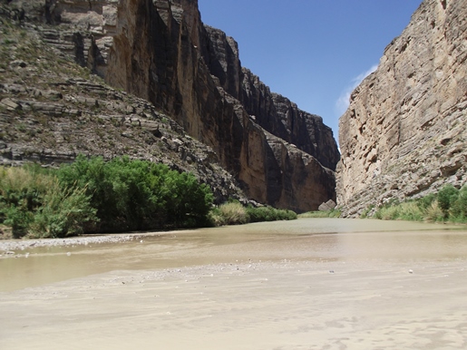
But we have one activity that reigns above all others: Hiking. A reader poll on Ranker.com puts Colorado well ahead of Washington, Utah, Oregon and Alaska in the top 5 states for hiking.

We’re talking everything from gentle walks through the meadows and forests of places like Mueller State Park in Teller County, to steep trails with incredible exposures along cliffs like the Dixon Trail in Cheyenne Mountain State Park, or the hundreds of miles of trails that meander through Rocky Mountain National Park.

And we hike 14ers. That’s shorthand for mountains with summits reaching 14,000 feet above sea level and higher. These are generally difficult trails due to elevation gain, length and oxygen-depleted altitude. We have more than four dozen 14ers in Colorado and it’s a badge of honor to conquer them on foot. Last summer, it’s estimated more than 334,000 people hiked Colorado’s 14ers. I can only imagine how many more people are hiking simple, everyday trails.

That’s a lot of people wandering around our outdoor spaces. And because a lot of them are new to Colorado and the outdoors, it’s a good time to talk about trail etiquette to keep the trip safe for yourself, others and the environment.

First, you need to approach a hike as you would a long vacation. Scope out your route to make sure it is the safest and most effective way of getting where we want to go. Don’t let your new trail adventure turn into a nightmare by getting lost. Research where trails begin and end and be realistic in judging your ability to cover the distance. Then plan to start early enough so you don’t end up hiking at a time of day that makes you feel unsafe. This is especially important if you get lost. Best to have daylight for searchers to have a chance of finding you.

Just as important is knowing the terrain. Anyone who has stepped on different textures of land understands that not all shoes work for all textures and trail grades. Walking shoes may be fine on a hard surfaced, flat trail but lousy if you will be on a dirt-and-gravel trail requiring climbing or a steep descent.

Make sure you have the proper gear to get you to and from, in an enjoyable and safe manner.

Next you need to think about food and water. And don’t tell me you don’t need to pack food because you’ll only be gone an hour or two. Think about what might happen if you get lost. Or if you get tired from exerting yourself at altitude more than you expected. Or you just get hungry. You will start to feel stressed and confused. Food and water are going to help you out.

With food and water you usually produce trash. And that brings me to an important trail etiquette rule: Pack it in, pack it out. It’s part of the “leave no trace” ethic of the outdoors. You’ve heard the expression: Leave only footprints and take only memories. Do not leave anything behind. Trash includes wrappers, bottles, toilet paper, bags with your pet poop, grocery bags and un-eaten food. This is critical because we share our trails with millions of people and other species.

Leaving no trace also means not cutting trees or moving rocks or picking plants. The ecosystem operates in the way it is intended, and we unfortunately don’t know enough to change it safely.

If you are lucky enough to hike a trail in solitude, don’t forget that there is always someone else who wants to enjoy the same scenery. Don’t ruin by leaving your trash - this includes dog waste bags where dogs are permitted on trails.

But more often, you won’t be alone on a route. Just like respecting other people on the highway, we must respect other people, and animals, on the trails. And the others you encounter won’t always be fellow hikers.

We share our trails with bikers and horse riders. While they may not be using the trails quite like you, they deserve just as much recreational freedom. It’s like the old saying, be nice to people and hopefully they will be nice back. If you share the trails with respect and dignity, they probably will, too.

One last request: Please keep your phone in your pocket while you are outdoors. OK, take a photo or two. Even a selfie, if you must. But do everyone a favor and don’t share every step of your journey. We are seeing headlines every day about people who die in the outdoors taking a dangerous selfie or walking off a cliff because they are looking at their phone instead of the trail and scenery.

The outdoors is a great chance to escape from the noise of your busy life. Immerse yourself in the serenity of Colorado’s great outdoor spaces. Put your phone away so that you aren’t distracted from the wonders around you.

Apply the right etiquette to your outdoor adventures, and you are sure to have no problems.

Just like everything else in life, we can enjoy the moments in what we do, while still managing to be safe doing it. Keep calm, and adventure on!


Jeff
HikingintheSmokys.com
RockyMountainHikingTrails.com
HikinginGlacier.com
TetonHikingTrails.com
Ramble On: A History of Hiking
Read More

Smokies Hosts Star Gazing Event at Purchase Knob

Wednesday, May 22, 2019

No comments
Great Smoky Mountains National Park is hosting a stargazing event on Friday, May 31 at the Appalachian Highlands Science Learning Center in North Carolina. Located on Purchase Knob at 5,000 feet in elevation, the learning center provides one of the clearest views of the sky from the Haywood County region of the park.

The Astronomy Club of Asheville will lead an exploration of the night sky at this high elevation site with a 260-degree unobstructed view of the sky. Visitors can expect to see many celestial wonders including star clusters, binary star systems, and other galaxies.

“National Park areas offer a wonderful opportunity to stargaze,” said Park Superintendent Cassius Cash. “National Parks across the country monitor and manage for natural night sky conditions in much the same way as we would to protect our air and water. Visitors are often amazed at the amount of stars that can be seen simply by entering into the natural darkness of Great Smoky Mountains National Park.”

The event starts at 8:00 p.m. with an indoor presentation of what can be seen in the nighttime skies during May. This presentation will be held rain or shine. The learning center is located at 5,000 feet in elevation so visitors should bring warm layers. The program is free, but participation is limited by parking availability. Participants must register in advance to reserve one of the 44 parking permits. Reservations can be made by registering through Eventbrite (www.eventbrite.com/o/astronomy-club-of-asheville-20250065100) or by calling 828-497-1907.

For more information about stargazing in the park, please visit the park’s website at www.nps.gov/grsm/learn/nature/dff509-focuspartner1.htm.


Jeff
HikingintheSmokys.com
RockyMountainHikingTrails.com
HikinginGlacier.com
TetonHikingTrails.com
Ramble On: A History of Hiking
Read More

Keep your distance from young or injured wildlife

No comments
Though this article is from Montana Fish, Wildlife and Parks, this information applies to anyone and everyone who ventures into the wild:

Each spring, Montana Fish, Wildlife and Parks receives several calls from people who have picked up deer fawns or other wildlife.

FWP advises against this practice for several reasons. The agency does not accept, hold or rehabilitate deer and elk because the animals rarely survive the stress of captivity, and because of concerns with the spread of disease. So FWP’s likely response would be to tell people to leave the animals alone or return them to where they were found.

While people mean well, they may not understand that their intervention could possibly kill the animal or cause injury to it or to themselves. Good intentions can lead to dire consequences.

Every spring, FWP receives calls from good-intentioned people who pick up great horned owls that have bailed out of the nest before they can fly. This is a natural part of their life cycle. The adult owls monitor these young, providing them with food until they can fly — usually just a couple of days. People can help best by not touching the owls and by keeping pets restrained.

In a high-profile case in Yellowstone National Park last summer, a bison calf was picked up and transported by tourists who believed it had been abandoned. The calf ultimately had to be euthanized because it couldn’t be reunited with the herd and continued to approach people and vehicles.

If You Care, Leave Them There

To prevent outcomes like this, FWP emphasizes that all wildlife species and their young should be left in the wild. If you see a young animal alone or injured, whether a goose or a grizzly, keep your distance. It is illegal to possess and care for a live animal taken from the wild.

Animals often thrive without human intervention, and their odds of surviving in the wild are much greater if they are left alone. Once young animals are picked up by people, they usually can’t be rehabilitated. People handling wildlife also may injure themselves or the animal, or habituate it to humans, potentially causing problems if the animal is released back into the wild.

Understanding Nature

It’s natural for deer, elk and other animals to leave their young alone for extended periods of time. What appears to be an orphaned animal may not be, but chances are the mother will not return while humans are present. Fawns are seldom orphaned, but if they are, another doe may add them to the group. In 8 to 10 days, a fawn will have the appropriate gut flora and can survive on its own by nibbling grass. Young fawns have no body odor, which lessens their appeal to predators. Their spots also help to camouflage them while their mothers stash them to feed.

If you take dogs into the field, be sure to keep your dog under control, especially in the spring when newborn wildlife is most vulnerable. Pet owners can be cited, and dogs that harass or kill wildlife may, by law, have to be destroyed.


Jeff
HikingintheSmokys.com
RockyMountainHikingTrails.com
HikinginGlacier.com
TetonHikingTrails.com
Ramble On: A History of Hiking
Read More

Report Armadillo Sightings in North Carolina to the Wildlife Commission

Tuesday, May 21, 2019

No comments
The N.C. Wildlife Resources Commission is asking the public to report any sightings of nine-banded armadillos to the agency.

Commission biologists are seeking observations to help them determine the range expansion of armadillos in the Tar Heel state. To participate, volunteers who spot an armadillo in the wild should upload and share their photos on the NC Armadillo project, which launched today on the free online platform iNaturalist. Volunteers can upload their photos via a computer at iNaturalist.org or they can download the free iNaturalist app, which is available for iPhone and Android.

People who want to report observations but do not want to use iNaturalist can send their armadillo observations to armadillo@ncwildlife.org. The email should include:

•A photo of the armadillo
•When it was observed (date and time)
•The location where it was observed (GPS coordinates are best, but a detailed location description is acceptable)

Armadillos are native to Central and South America but have gradually expanded their range into the southeastern United States. In 2007, the agency received the first confirmed sighting of a nine-banded armadillo in Macon County and in the last 12 years has received more than 170 reports in 46 counties.

The number of counties with confirmed observations is 27, stretching from Cherokee to Dare counties, and makes it likely the armadillo is expanding its range naturally throughout North Carolina, rather than being helped by human intervention, according to Colleen Olfenbuttel, the Commission’s black bear and furbearer biologist.

“Whether armadillos continue spreading beyond their current range will be largely determined by climate,” said Olfenbuttel. “Mild winter temperature conditions are good for armadillos. Since they lack thick insulation and must dig for most foods, freezing conditions can cause them to starve or freeze to death. “However, North Carolina is experiencing fewer long stretches of below freezing weather, which is allowing armadillos to expand northward.”

Learn more about armadillos by reading the Commission’s armadillo species profile and visiting the armadillo webpage.


Jeff
HikingintheSmokys.com
RockyMountainHikingTrails.com
HikinginGlacier.com
TetonHikingTrails.com
Ramble On: A History of Hiking
Read More

TVA Grant Funds Park Programs for Boys & Girls Club

Monday, May 20, 2019

No comments
Friends of the Smokies has been awarded a $5,000 grant from the Tennessee Valley Authority (TVA) to fund summer programs in Great Smoky Mountains National Park (GSMNP) for urban youth in partnership with the Boys & Girls Club of the Tennessee Valley.

Funds provided by TVA will pay transportation expenses for elementary aged students in Knoxville to visit GSMNP this summer. These summer programs and activities will expose young people to the natural wonders of the Great Smoky Mountains including science and social studies education initiatives that reinforce Tennessee school curricula. Park Rangers will go on-site to the Boys & Girls Clubs to present fun, hands-on activities that help the children become comfortable with the rangers and begin learning about the park’s natural ecosystems. The program also provides a summer day camp experience with one-day in-park field trips to learn about the cultural history of the area and the park’s natural biodiversity.

Most of the students participating in this program are from Title I schools, which include students near or below the poverty level, qualifying for the free or reduced lunch program, and are at the most risk of failure. Their participation in the program will be at no cost to them or their families. Friends of the Smokies anticipates reaching more than 1,500 students through the summer program for urban youth in 2019.

“We are excited to fund this summer education program in the Smokies again this year,” said Tim Chandler, Friends of the Smokies Executive Director & CEO. “These kids are the next generation of park users and stewards, so we will jump at any chance we have to reach them and introduce them to the wonders of the natural world in Great Smoky Mountains National Park.”

Friends of the Smokies will provide an additional $5,000 towards the program through proceeds from its specialty license plate program in Tennessee. For an additional $35 annual fee, drivers all across Tennessee can support programs like this with a specialty license plate featuring a black bear and sunset over the Great Smoky Mountains. Learn more at BearPlate.org or visit your local county clerk’s office.


Jeff
HikingintheSmokys.com
RockyMountainHikingTrails.com
HikinginGlacier.com
TetonHikingTrails.com
Ramble On: A History of Hiking
Read More

Recommended Gear For Hiking In The Smoky Mountains

Sunday, May 19, 2019

No comments
The following is a guest post from dopeoutdoors.com:

The Great Smoky Mountains are one of the most popular hiking locations in the USA, in fact, I think it is fair to go one step further and say it is one of the most popular hiking spots in the world. But before you head to the Great Smoky Mountains you need to ensure you have your essential gear.

Any hiker will tell you that there is a lot of essential gear you need if you want to go hiking. When tackling hiking trails like those found on the Great Smoky Mountains there is going to be a lot you need to ensure you have with you. So, read on to find out what essential hiking gear is needed.

Your Outfit

We can split your essential gear for a hike through the Smoky Mountains into two main categories. Your outfit is very important and if you want your hike to be safe and comfortable at all times you need to ensure you are wearing the right clothing.

Light Hiking Jacket

Hiking jackets are often overcomplicated by many people of course what you need will vary depending on the weather but as a minimum, you are best going with a lighter jacket. Of course, if you are expecting rain or worse go for something a little thicker.

Backpack

A backpack is essential for longer hiking trips if you are hiking in a group then not everyone will need one but a small to medium light backpack is your best option to ensure you have room to carry everything without being weighed down too much.

Thick Socks

Shoes are important on a hike but you shouldn’t forget about your socks either. Thick wool socks are often going to be your best option to ensure your ankles are better supported and more comfortable.

Hiking Shoes

Hiking shoes are another complicated issue you might think a good pair of hiking boots is all you need but sometimes actually opting for a pair of strong tennis shoes can be just as effective. This one will usually come down to the type of trail you are doing but if you are struggling to make a decision stick with a good pair of hiking boots.

Safety Gear

Now let’s focus on the safety equipment you need to ensure your hiking is a success. With over 100 different trails suitable for beginners to veterans there is plenty of diversity at the Smoky Mountains. “It is always best to have this essential safety gear with you” says dopeoutdoors.com.

Compass

It might sound cliché but a compass can really come in handy particularly on longer trails around the Smoky Mountains. Make sure you familiarize yourself with how to use it though as it isn’t always as easy as it appears to be.

Water Bottle

A water bottle is vital for any hike, even if you are going on an easy trail and a short hike I would still strongly advise having a water bottle with you. Getting lost especially on trails, especially ones you aren’t familiar with is always going to be a risk. So, pack along a water bottle and if the weather is particularly sunny bringing along an extra is going to be a good idea.

Protein Bar

A water bottle is an essential part of your gear but water isn’t the only thing you will need. A protein bar is great for getting some extra energy and will also help satisfy your hunger. You can build up quite the appetite when hiking especially on longer more intensive trails.

Torch

Bringing a good torch or flashlight if you prefer is going to be a great way to ensure you never get lost. You might start out a hike and fully expect to get back before it gets dark but you never know what will happen so always ensure you have a light source with you. Many people rely on their phones for a flashlight these days but a proper torch is always going to be the better option.

First-Aid Kit

A miniature first-aid kit is an often overlooked part of your hiking gear but no hiker should attempt the Smoky Mountain hiking trails without one. Trips and falls can happen and hiking injuries are always a risk so make sure you have a first-aid kit ready just in case. For more details on how to stay safe, take a look at this hiking checklist here.

Map

With so many different trails to tackle at the Smoky Mountains a map is incredibly important. Making your own map online isn’t really recommended instead stick to buying professional sourced more in-depth detailed ones. The Smoky Mountains is home to many different hiking trails on some you might find some of the gear we’ve suggested not overly helpful. But for others, it will be of vital importance so it is best to be covered for every trail, isn’t it? Plus with this gear, you can be sure of a more productive, safe and peaceful hiking experience.


Jeff
HikingintheSmokys.com
RockyMountainHikingTrails.com
HikinginGlacier.com
TetonHikingTrails.com
Ramble On: A History of Hiking
Read More

Gear Review: Kuhl Renegade Cargo Short

Saturday, May 18, 2019

No comments
Earlier this week I had the opportunity to test my new pair of Renegade Cargo Shorts during a hike in our local park. The Renegade is made by Kühl, an outdoor clothing company based out of Salt Lake City, Utah.

The Kuhl website states that "Going off the grid takes more organization than you might think." The Renegade Cargo Short "features pockets inside other pockets to ensure your important items are secure. And the DURALUX™ fabric feels soft while giving you enough stretch to go anywhere you want to go. Get organized for the adventure ahead with men's cargo shorts made with innovative features." The product description continues by stating that "DURALUX™ feels like cotton, superior anti-abrasion, stronger, softer, more breathable than standard nylon."

By all appearances the Renegade Cargo Short is a very well-made pair of shorts. Despite being made with durable fabric, the Renegade feels fairly soft, and more importantly, is extremely comfortable. I also appreciate the ample pocket space. I own a well-known brand of hiking shorts that doesn't even have back pockets. In another well-known brand of hiking shorts that I own the pockets are extremely shallow, with barely enough room to fit my normal-sized wallet. The back pockets on the Renegade are the perfect size. Additionally, the Renegade sports side and front pockets as well.

At first I thought the shorts felt a little tight when I first put them on. However, after wearing them around the house for awhile they seemed to fit my form more naturally. Not only will I be wearing them on hikes, but the design looks so great that I'll also be wearing them around town as well.

My only real complaint with the Renegade Cargo Short is their length, which comes just over my knee-caps. Style-wise, I'm more of a fan of shorter shorts. This is just a personal preference, however.

All in all I think the Renegade is a great pair of shorts, and look forward to wearing them in the mountains this upcoming season. For more information on the Kuhl Renegade Cargo Shorts, please click here.


Jeff
HikingintheSmokys.com
RockyMountainHikingTrails.com
HikinginGlacier.com
TetonHikingTrails.com
Ramble On: A History of Hiking
Read More

Blue Ridge Parkway Announces 2019 Pavement Preservation Work

Thursday, May 16, 2019

No comments
The National Park Service announced today that over 115 miles of the historic motor route in three primary areas will be resurfaced as part of a pavement preservation program on the Blue Ridge Parkway. Work is expected to start in late-May and continue through November of 2019, with no work scheduled during October. Work locations, within scheduled project areas, will change weekly and visitors in active work zone areas should expect single lane closures and delays. The National Park Service appreciates the public’s patience and cooperation during this project.

Work will take place on the following sections of Parkway, and includes the paved road-side pullouts:

•Milepost 175 to 217, Mabry Mill to Cumberland Knob area (42 miles)
•Milepost 241 to 262, Doughton Park to West Jefferson area (21 miles)
•Milepost 292 to 345, Cone Memorial Park to NC Minerals Museum area (53 miles)

As with any road project, motorists and park users must exercise caution. In the interest of visitor safety, park visitors are asked to:

•Check the Parkway’s Real Time Road Map for regularly updated work zone information.
•Expect delays while work takes place Monday through Friday. Lane closures will be managed with flagging operations and a pilot car to lead traffic through work zones.
•Observe reduced speed limits in work zones, 24 hours a day, 7 days a week; to maintain safe operations and allow for proper curing of pavement.
•Anticipate loose gravel on the road surface during pavement curing times. Bicyclists and motorcyclists are asked to exercise extreme caution as loose gravel on top of the paved surface, during the required curing time, could result in loss of control. On-site message boards will recommend alternate routes.
•When circumstances prevent bicyclists from keeping up with traffic, dismount and move off of the road to let the on-coming traffic pass when traveling through a single lane closure.

Project vendors will work in short sections and repeat the resurfacing process as they move from section to section of the full project. The steps in this process include prepping the surface, applying a chip seal surface of liquid asphalt and stone chips, allowing the surface to properly cure, vacuuming the work area to minimize loose gravel, applying a fog seal on top of the chip seal surface, and finishing by painting new road marking lines. The process will then repeat on the next section of the project.

The Blue Ridge Parkway inventory of paved roads includes bridges, tunnels, parking areas, spur roads, service roads, campground and picnic area roads, and the 469-mile Parkway motor route itself. Given the large inventory of paved surfaces along the Parkway, and in order to effectively invest available funding, the pavement preservation strategy focuses on keeping the good sections good and returning fair sections to good condition.

Pavement preservation is becoming a regular road maintenance strategy in national parks. Studies find that for each dollar spent on pavement preservation between $6 and $10 in future pavement rehabilitation costs are saved. Funding for road maintenance in national parks, including the Parkway, comes in large part from the Highway Trust Fund, which is derived from a federal gas tax managed by the Federal Highway Administration.


Jeff
HikingintheSmokys.com
RockyMountainHikingTrails.com
HikinginGlacier.com
TetonHikingTrails.com
Ramble On: A History of Hiking
Read More

Appalachian Trail Conservancy Comments on the Assaults on Hikers in Southwest Virginia

Wednesday, May 15, 2019

No comments
The following is a statement from Suzanne Dixon, president of the Appalachian Trail Conservancy, on the assaults on hikers in Southwest Virginia:
“The Appalachian Trail community of hikers and volunteers is profoundly saddened by the horrific attack Saturday morning on two hikers as they took their ‘journey of a lifetime’ along this beloved footpath,” says Suzanne Dixon, president of the Appalachian Trail Conservancy (ATC).

She continued, “The Appalachian Trail is a safe environment, a refuge that welcomes more than three million users a year. Unfortunately, like the rest of the world, the trail is not absolutely safe from evil.”

“The ATC extends its deepest condolences to the family of Ronald Sanchez and prays for the fullest possible recovery of the hospitalized woman. Those feelings extend to all hikers and volunteers who are scarred in some way by this attack on a place they cherish and care for every day,” she concluded.

The ATC — a private nonprofit, the members of which conceived and blazed the A.T. in the 1920s and 1930s — manages and conserves the 250,000 acres of public lands that comprise the Appalachian National Scenic Trail. It undertakes this in cooperation with the National Park Service, the USDA Forest Service, 14 states from Maine to Georgia, and 31 affiliated local clubs. The clubs are home to most of the 6,000 volunteers who maintain the footpath and its facilities through about 250,000 hours of work annually.

The attacks took place on Forest Service lands in southwest Virginia, the current location of the main “bubble” of about 3,000 persons attempting to hike all the way from Georgia to Maine this season. The southern end of the Trail is about 550 miles from the scene of the assaults. The Trail became a unit of the National Park System in 1968.


Jeff
HikingintheSmokys.com
RockyMountainHikingTrails.com
HikinginGlacier.com
TetonHikingTrails.com
Ramble On: A History of Hiking
Read More

Big Bend National Park

Monday, May 13, 2019

No comments
After leaving White Sands National Monument, Kathy and I headed southeast towards Alpine, Texas. Along the way we were scheduled to stop at the McDonald Observatory, located in the Davis Mountains just northwest of Alpine, to take part in their Tuesday night "Star Party". If you saw my post from White Sands, you'll likely notice large billowy clouds in my photos. Those clouds proceeded to develop into major thunderstorms. Fortunately our route took us completely around these storms. However, as got to Van Horn and beyond, more clouds began to develop. We thought for sure the Star Party would be canceled. However, once we arrived at the observatory, which sits atop a relatively low mountain, we enjoyed clear skies above us - though heavy clouds and storms threatened in all directions. As the sun set, and darkness enveloped the mountain, our luck continued as the Star Party went-off as scheduled, and we were able to view the stars through several telescopes. To be honest though, we were both pretty disappointed in the "party". We thought we would be looking at supernovas and planets in great detail, but the telescopes simply did not provide that amount of power. The best part of the party was watching the lightning that seemed to spark all around us in the far-off distance.

After getting to our hotel around midnight, we were awakened early the next morning by a raging storm that looked like a hurricane from our third floor window. Just south of town we passed several mounds of hail that had accumulated from the storm. Fortunately we weren't impacted by any severe weather as we drove south towards Big Bend National Park. By the time we reached the outskirts of the park we could see a massive storm raging over the east side of the park. Our primary destination, Santa Elena Canyon, was on the west side of the park, and appeared to be under blue skies. So far so good! However, once we arrived at the trailhead we found out that Terlingua Creek was impassable due to heavy rains. We were only able to see the mouth of this spectacular canyon:


After hiking a couple of other trails on the west side of the park, we began making our way towards the east. As we progressed we could see massive storm clouds brooding towards the north. By this time it was late afternoon and we were essentially done with our visit, and were really hoping that we would be able to avoid severe storms as we headed north towards Fort Stockton. Before heading out of the park we stopped at the visitor center in Panther Junction, located near the north-central portion of the park. Here we saw a car totally destroyed by hail. There were large pock marks on the hood and trunk, and their windshield was completely destroyed. They had been waiting for several hours for a tow truck. Fortunately for us, our route took us around the storm as we headed towards the northeast.

Here are a few other photos from our time in the park:


Jeff
HikingintheSmokys.com
RockyMountainHikingTrails.com
HikinginGlacier.com
TetonHikingTrails.com
Ramble On: A History of Hiking
Read More

Flash Sale: half-off on "Ramble On: A History of Hiking" today

Friday, May 10, 2019

No comments
As you're likely already aware, I published my new book, Ramble On: A History of Hiking, last fall. Today, I wanted to announce that for a very limited time the eBook version of the book will be on sale. Beginning at 10:00 am EST today you will be able purchase the eBook version for only $4.99 on Amazon - a 50% discount off the regular price of $9.95. You can take advantage of this limited time offer until 2;00 pm today. For more information on the book, and to purchase, please click here.

Additionally, if you like the book, I would really appreciate if you could write a short review on my Amazon page.

Thank you very much!


Jeff
HikingintheSmokys.com
RockyMountainHikingTrails.com
HikinginGlacier.com
TetonHikingTrails.com
Ramble On: A History of Hiking
Read More

Smokies Invites Volunteers to an Appalachian Trail Work Day

Thursday, May 9, 2019

No comments
Great Smoky Mountains National Park staff and partners invite volunteers to participate in a service opportunity in celebration of National Trails Day on Saturday, June 1. The national park is once again working with the Friends of the Smokies, the Appalachian Trail Conservancy Regional Office, and the Smoky Mountain Hiking Club to host this large volunteer event on the Appalachian Trail.

This annual work day event has taken place in the park for 23 years and highlights the important work done by volunteers and the importance of trails for recreation, education, and physical fitness. The Appalachian Trail Work Day provides an opportunity for the public to help the Appalachian Trail Maintainers with important trail projects that might not otherwise get accomplished. The work done on the Appalachian Trail during National Trails Day provides hikers with a safe, enjoyable trail experience and protects the resources around the trail.

“This event provides a great opportunity for park supporters to help maintain the Appalachian Trail,” said Superintendent Cassius Cash. “Focusing such a large volunteer effort on one of the highest used trails in the park is a great way to honor National Trails Day and have lasting positive impact on the experience of thousands of hikers who use the trail each year.”

Volunteers will assist with a variety of projects, from cleaning and replacing water bars, rehabilitating steps and turnpikes, to improving trail tread on sections and packing in mulch along the Appalachian Trail between Icewater Spring to Silers Bald and Davenport Gap to Mt. Cammerer.

Pre-registration is required to allow for proper planning for the projects. Tools and safety equipment will be provided. This event is free to participate and all those who participate will receive a commemorative t-shirt. The workday concludes with a picnic at the Twin Creeks Picnic Pavilion. Participants should wear sturdy shoes, dress appropriately and bring lots of water and a lunch for the day.

The registration deadline is May 15. For more information and to register for this work day, visit the Smoky Mountain Hiking Club website. You may register online at www.smhclub.org/forms/NTD2019.htm or you may print and mail the form to the address listed on the form. If you need additional assistance, contact Diane Petrilla at 931-224-5149.


Jeff
HikingintheSmokys.com
RockyMountainHikingTrails.com
HikinginGlacier.com
TetonHikingTrails.com
Ramble On: A History of Hiking
Read More

White Sands National Monument

Wednesday, May 8, 2019

No comments
After leaving the Santa Fe area we drove down to White Sands National Monument in south-central New Mexico. It was truly another world. The sand is pure white, and looks like snow in many places. Driving in certain places, or pulling into some parking lots you would've thought that you would need snow tires.

White Sands is the world's largest gypsum dunefield, which encompasses roughly 275 square miles of desert below the San Andres Mountains. The national monument preserves a major portion of this unique dunefield. Because the park is surrounded by the White Sands Missile Range and the Holloman Air Force Base, the park is closed for short periods due to missile testing. Therefore, it's always important to call or check the park website on the day of your visit to make sure the park is open.

White Sands National Monument has been featured in several films, including Four Faces West (1948), Hang 'Em High (1968), The Hired Hand (1971), My Name Is Nobody (1973), Bite the Bullett (1975), Young Guns II (1990), White Sands (1992), King Solomon's Mines (1950), The Man Who Fell to Earth (1976), and Transformers (2007).

White Sands is also the site of the detonation of the world’s first atomic bomb, located roughly 60 miles north of the monument. Now known as the Trinity Site, the bomb was detonated on July 16, 1945.

Here are a few photos from our visit:


Jeff
HikingintheSmokys.com
RockyMountainHikingTrails.com
HikinginGlacier.com
TetonHikingTrails.com
Ramble On: A History of Hiking
Read More

Trillium Gap Trail Rehabilitation Begins May 13

Tuesday, May 7, 2019

No comments
Great Smoky Mountains National Park officials announced that a 2-year trail rehabilitation project will begin next week on Trillium Gap Trail. Due to the construction process on the narrow trail, a full closure is necessary for the safety of both the crew and visitors. The trail and associated parking lot along Roaring Fork Motor Nature Trail will be closed May 13 through November 15 on Monday mornings at 7:00 a.m. through Thursday evenings at 5:30 p.m. weekly. The trail will be fully open each week on Friday, Saturday, and Sunday and on federal holidays.

Trillium Gap Trail is one of the busiest trails in the park as it provides access to the popular Grotto Falls and the summit of Mt. Le Conte. There will not be any access to Grotto Falls during the weekday closures. Hikers can still reach Mt. Le Conte, LeConte Lodge, and the Le Conte Shelter by using one of the other four trails to the summit including the recently restored Rainbow Falls and Alum Cave Trails.


We recently celebrated the 10-year anniversary of the Trails Forever partnership with the Friends of the Smokies and I couldn’t be more proud of the amazing work accomplished by our crews, youth interns, and volunteers in transforming trails across the park,” said Superintendent Cassius Cash. “While we hate to disappoint hikers with weekday closures, the results are well worth the inconvenience and allow us the opportunity to continue to protect these special places for generations to come.”

The trail crew will focus rehabilitation efforts on several targeted locations along the entire length of the trail stretching from the Rainbow Falls Trail parking area to the summit of Mt. Le Conte. The work will improve overall trail safety and protect natural resources by improving the tread surface, reducing trail braiding, and improving drainage to prevent further erosion. There are several areas along the trail where erosion and small landslides have damaged significant sections, making the trail difficult to follow. In addition to the work on Trillium Gap Trail, trail crews will perform critical trail work across the park as part of the Trails Forever program including rehabilitation along Deep Creek Trail, Rough Fork Trail, Smokemont Trail, and Noah Bud Ogle Trail.

Trails Forever is a partnership program between Great Smoky Mountains National Park and the Friends of the Smokies. The Friends have donated over $1,500,000 to support the program, in part through the generosity of the Knoxville based Aslan Foundation. The Trails Forever program provides the opportunity for highly skilled trail crew members to focus reconstruction efforts on high use and high priority trails in the park including Rainbow Falls, Alum Cave, Chimney Tops, and Forney Ridge trails. The program also provides a mechanism for volunteers and interns to work alongside the trail crew on these complex trail projects to assist in making lasting improvements to preserve the trails for future generations.

Volunteer work days for the Trails Forever program are held every Wednesday, May through August. Prior registration is required. Please contact Trails and Facilities Volunteer Coordinator Adam Monroe at 828-497-1949 or adam_monroe@nps.gov for more details and to register.


Jeff
HikingintheSmokys.com
RockyMountainHikingTrails.com
HikinginGlacier.com
TetonHikingTrails.com
Ramble On: A History of Hiking
Read More

Shenandoah National Park Hosts Wildflower Weekend 2019

No comments
Native spring wildflowers and nature art will be celebrated during Shenandoah National Park's 33rd annual Wildflower Weekend, May 11-12, 2019. Special hikes and programs will focus on the diversity and importance of hundreds of species of flowering plants that are protected by the park.

Visitors may view the winning entries in the park’s annual “Youth Art in the Park” wildflower art contest. The top-winning works will be exhibited at Byrd Visitor Center (mile 51on Skyline Drive) from May 11 to17 and at Dickey Ridge Visitor Center (mile 4.6) from May 18 to 24. Winning artists will be recognized in a ceremony at noon Saturday, May 11, at Byrd Visitor Center.

The special feature this year is a botanical art workshop led by watercolor artist Betty Gatewood at Byrd Visitor Center on May 11 from 1:30 to 4:30 p.m. No art experience is necessary, and all materials will be provided. Artist-in-Residence Julie Elkins will demonstrate sculpting with activities for visitors on May 11 and 12 from 9:30 to 11:30 a.m. at Byrd Visitor Center.

Hikes include South River Falls, Hawksbill Summit, Passamaquoddy Loop, Millers Head, Mill Prong Trail and the Appalachian Trail to Bearfence Mountain, as well as a birding walk.

All programs are free. No reservations are needed. However, there is a $30 entrance fee to the park (good for seven days). Adults and children are welcome on all Wildflower Weekend programs. The complete program schedule is posted on the park’s special events page: https://www.nps.gov/shen/upload/2019_WildflowerWeekend_web.pdf.


Jeff
HikingintheSmokys.com
RockyMountainHikingTrails.com
HikinginGlacier.com
TetonHikingTrails.com
Ramble On: A History of Hiking
Read More

Tent Rocks in Black and White

Monday, May 6, 2019

No comments
Last week Kathy and I returned home from a two-week tour of New Mexico and Texas. Along the way we did several hikes in Big Bend National Park and Enchanted Rock State Park in Texas, as well as Bandelier, White Sands and Tent Rocks national monuments in New Mexico. During the New Mexico leg of our trip we had the opportunity to do a few hikes with our niece and nephew. The following are a few photos from Tent Rocks, captured in black and white (Kathy and I have hiked in this area in the past):


The odd cone-shaped formations that give the area its name are the products of volcanic eruptions that occurred 6 to 7 million years ago which left pumice, ash and volcanic tuff deposits over 1,000 feet thick. Over time, wind and water slowly eroded the tuff, which formed the canyons and tent rocks we see today. Some of these hoodoos, or tent rocks, reach up to 90 feet in height. The only other place in the world where you can find these unusual rock formations is in the Cappadocia region of Turkey.


Jeff
HikingintheSmokys.com
RockyMountainHikingTrails.com
HikinginGlacier.com
TetonHikingTrails.com
Ramble On: A History of Hiking
Read More

Smokies License Plates Pass New Milestone in Tennessee and North Carolina

Sunday, May 5, 2019

No comments
Twenty years after the launch of the program, drivers in Tennessee and North Carolina have raised more than $15 million in support of Friends of the Smokies through specialty license plate sales. The iconic black bear is depicted on both states’ plates and contributes to their popularity on both sides of the mountains.

The Tennessee Smokies plate underwent a multi-year redesign and hit the roads in winter 2018. It features a silhouette of a black bear against the original orange and purple sunset design. Less than six months later, sales increased by 30% over the same time in the previous year. A black bear was added to the North Carolina Smokies plate in 2007 and sales have seen a steady increase since then, placing the Smokies plate among the most popular in the state with representation in all 100 counties.

“It’s a wonderful feeling knowing that from the Outer Banks of North Carolina to the banks of the mighty Mississippi, there are generous people who support this national park with our specialty license plates,” said Tim Chandler, Executive Director and COO of Friends of the Smokies. “These plates provide meaningful and dependable support for the critical projects we fund in the Smokies.”

Both specialty plates fund a variety of projects and programs in Great Smoky Mountains National Park, including those related to the park’s black bear population. Last year, the plates also provided support for a new Preventative Search and Rescue (PSAR) program, a coordinated volunteer effort to provide valuable information to hikers at trailheads about trail safety, trail difficulty, and proper preparation before beginning a hike.

“We are heading into another busy year for the Smokies,” says Chase Pickering, Friends of the Smokies board member, “visitation was at an all-time high last year, and that trend looks like it’s going to continue for 2019. It’s amazing to think you can do something as simple as getting a license plate to support your national park. Having a bear on the plate is just a bonus.”

The North Carolina Smokies plate was designed by Micah McLure. The Tennessee Smokies plate was designed by Kristin Williams. For more information or to get a plate visit BearPlate.org or stop by your local Tennessee County Clerk’s Office or North Carolina Vehicle and License Plate Office.


Jeff
HikingintheSmokys.com
RockyMountainHikingTrails.com
HikinginGlacier.com
TetonHikingTrails.com
Ramble On: A History of Hiking
Read More

Mazamas Review "Ramble On: A History of Hiking"

Thursday, May 2, 2019

No comments
Earlier this week the Mazamas, one of the oldest mountain clubs in America, published a review of my new book, Ramble On: A History of Hiking. I want to sincerely thank Brian Goldman for publishing his detailed review of the book in the latest edition of Mazama Bulletin, the monthly magazine of the Mazamas.

Mr. Goldman concluded his extensive review by stating: "Overall, this book is a very comprehensive, all-encompassing overview for anyone interested in the history of hiking."

To read the entire review (on page 24), please click here.


Jeff
HikingintheSmokys.com
RockyMountainHikingTrails.com
HikinginGlacier.com
TetonHikingTrails.com
Ramble On: A History of Hiking
Read More

Blue Ridge Parkway Opens Comment Period for Planned Bridge Projects near Ashe and Alleghany Counties

Wednesday, May 1, 2019

No comments
The National Park Service announced today, in cooperation with the Federal Highway Administration and in accordance with the National Environmental Policy Act, that a public comment period is open for a Draft Environmental Assessment prepared for two bridge improvement projects on the Blue Ridge Parkway. The first project, known as Project 2A16, includes the rehabilitation of Big Pine Creek Bridge #3 and #6 and Brush Creek Bridge #1 in Ashe County, NC, with an emphasis on maintaining the historic character of the bridges to the maximum extent practicable. The second project, known as Project 2D17, involves the replacement of a larger historic bridge, Laurel Fork Bridge in Alleghany County, which would be designed with consideration given to the historic character of the Blue Ridge Parkway and the original bridge.

The Parkway has over 180 bridges in its asset inventory. Planning for these projects began in 2016, and work is expected to begin in 2020. The bridges involved in these projects have been deemed structurally deficient with deteriorating decks and substandard height bridge rails. The proposed projects will address structural deficiencies and improve safety by meeting current roadway design standards, including installation of crashworthy railings.

This Environmental Assessment will be on public review from May 1, 2019 through June 1, 2019. During this 30-day period, hardcopies of the document may be requested by contacting Dawn Leonard, NPS Community Planner, at (828) 348-3434. An electronic version of this document can be found on the NPS’s Planning Environment and Public Comment (PEPC) website at: https://parkplanning.nps.gov/projectHome.cfm?projectID=82234. The public is invited to review and comment on the document at this link by June 1, 2019.


Jeff
HikingintheSmokys.com
RockyMountainHikingTrails.com
HikinginGlacier.com
TetonHikingTrails.com
Ramble On: A History of Hiking
Read More